Trips Places Foods Stories Newsletters
Loading...
Loading...
Loading...
Loading...

No search results found for
“”

Make sure words are spelled correctly.

Try searching for a travel destination.

Places near me Random place

Popular Destinations

  • Paris
  • London
  • New York
  • Berlin
  • Rome
  • Los Angeles
Trips Places Foods Stories Newsletters
Sign In Join
Places near me Random place
All the United States New Mexico Cabezon Peak

Cabezon Peak

This towering volcanic plug stands out among the dramatic formations that dot this otherworldly desert valley.

New Mexico

Added By
syabek
Email
Been Here
Want to go
Added to list
CAPTION
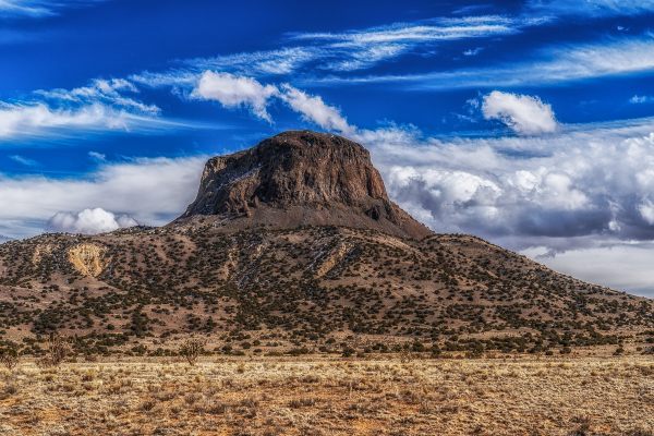
Cabezon Peak   syabek / Atlas Obscura User
Full Moon setting near Cabezon Peak.   syabek / Atlas Obscura User
Cabezon Peak seen from US 550.   syabek / Atlas Obscura User
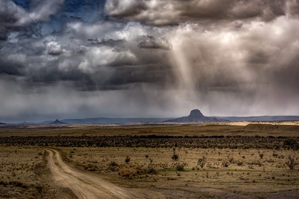
Storm over Cabezon Peak.   syabek / Atlas Obscura User
The Rio Puerco Valley.   syabek / Atlas Obscura User
Iglesia de San Luis near Cabezon Peak.   syabek / Atlas Obscura User
May 2020   ndlobrecht / Atlas Obscura User
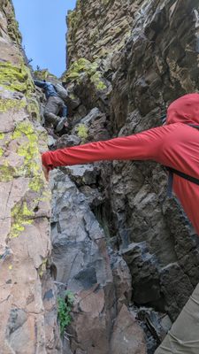
Looking up one of the difficult scrambling sections   mikewalker / Atlas Obscura User
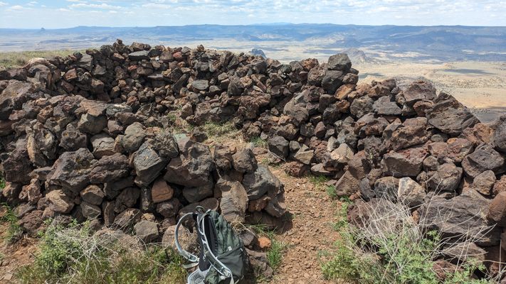
The summit shelter atop Cabezon Peak   mikewalker / Atlas Obscura User
Been Here
Want to go
Added to list

About

With an elevation of nearly 8,000 feet, Cabezon Peak is the largest of over 50 dramatic volcanic formations that dot the otherwise barren and otherworldly desert shrubland of the Rio Puerco Valley.

Cabezon Peak is a steep-sided and symmetrical basalt volcanic plug that formed during the eruptions of the Mount Taylor volcanic field millions of years ago. The basalt monolith is one of the most prominent landmarks in northwestern New Mexico, dominating the landscape. Visitors with a keen eye will notice it bears a striking similarity to the larger Devils Tower in Wyoming, which is also a basalt volcanic plug.

Cabezon, which is derived from the Spanish and translates as “big head,” is believed to have religious significance for the local Pueblo and Navajo Indians. Numerous myths abound, but a particularly popular Navajo legend holds that a giant was slain on Mount Taylor, located to the west, and the giant's severed head landed to the east, becoming Cabezon Peak. As the legend goes, the giant's blood congealed to form the volcanic lava flows to the south.

The views from the summit of Cabezon Peak are impressive, looking out over much of northern and central New Mexico. Accordingly, the 1.9-mile hike to the top is a favorite among climbers. It is not, however, for the faint of heart. Basic mountain climbing experience and proper gear, including a helmet, are required for this technical climb along the scree-covered trail and up the nearly vertical cliffs. Acrophobes will definitely find this climb unpleasant. 

Related Tags

Volcanoes Geology Geological Oddities Martian Landscapes Mountains Hiking Legends Ecosystems

Know Before You Go

Cabezon Peak is part of the Cabezon Wilderness Study Area. To reach the area from Albuquerque, take I-25 north about 17 miles to US 550 West. Travel 41 miles on US 550 and turn left on NM 279. Cabezon Peak will be visible to the west. NM 279 is a relatively lonely road that passes through the sleepy village of San Luis.

The pavement ends after nine miles. Continue on 279 and bear left at the fork. In 3.8 miles, there will be an obvious gravel parking lot and a prominent BLM sign indicating the Cabezon Peak Wilderness Study area. There is about a one-mile hike along the old (closed) two-track road to the mountain's base, with about one mile to the top. That mile will cover everything from Class 1 hiking to Class 4 scrambling.

No fees or permits are required. Be mindful that the dirt roads become extremely slippery and possibly impassable when it rains. There are no services. The trail is not recommended for pets or children.

Community Contributors

Added By

syabek

Edited By

CorpseLady84, mikewalker, ndlobrecht

  • CorpseLady84
  • mikewalker
  • ndlobrecht

Published

February 11, 2019

Edit this listing

Make an Edit
Add Photos
Cabezon Peak
Cabezon Peak
New Mexico, 87053
United States
35.599765, -107.095524

Nearby Places

Walatowa Slot Canyon

Jemez Pueblo, New Mexico

miles away

Jemez Springs Library Human Sundial

Jemez Springs, New Mexico

miles away

Jemez Historic Site

Jemez Springs, New Mexico

miles away

Explore the Destination Guide

Photo of New Mexico

New Mexico

United States

Places 179
Stories 20

Related Places

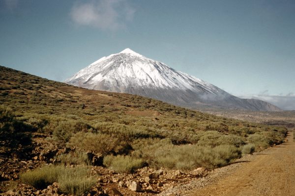
  • Mount Teide

    Tenerife, Spain

    Mount Teide

    According to the Guanches, the aboriginal people of the Canary Islands, the king of evil lives inside this volcano.

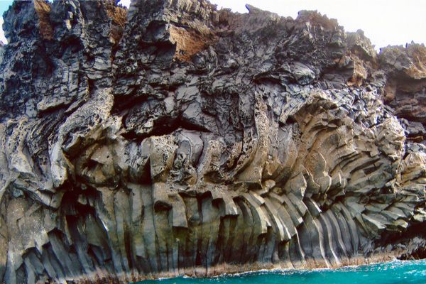
  • Columnar basalt along the Kanaio Coast.

    Wailea-Makena, Hawaii

    Kanaio Coast

    A cooled lava flow from the Haleakalā volcano formed these surreal-looking columnar basalt structures.

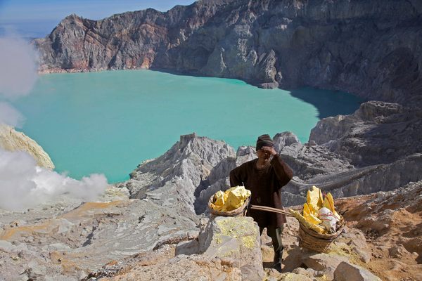
  • The lake is 90 degrees and acid and would kill any swimmer

    Banyuputih, Indonesia

    Kawah Ijen

    Think you have a tough job? Try carrying 200 kilos through a cloud of sulfur down the side of a volcano.

  • Looking down into the lava lake

    Antarctica

    Mount Erebus

    Fire meets ice at the southernmost volcano on Earth.

  • Gas vents bubbling away at the top.

    Minbu, Myanmar (Burma)

    Minbu Mud Volcanoes

    These muddy eruptions are less deadly than actual volcanoes but also more holy.

  • Sierra Bullones, Philippines

    Chocolate Hills

    Bohol's unusually shaped hills turn brown in the summer months

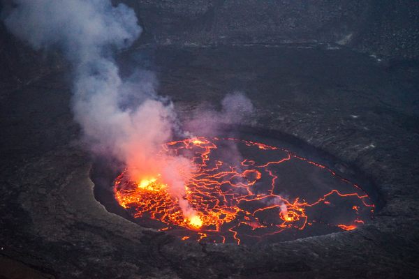
  • Nyiragongo Volcano in 2016

    Democratic Republic of the Congo

    Nyiragongo Volcano

    Mount Nyiragongo has erupted at least 34 times since 1882 and is home to the world's largest lava lake.

  • Baku, Azerbaijan

    Yanar Dağ (Fire Mountain)

    Mysterious hillside with a continuously burning natural fire.

Aerial image of Vietnam, displaying the picturesque rice terraces, characterized by their layered, verdant fields.
Atlas Obscura Membership

Become an Atlas Obscura Member


Join our community of curious explorers.

Become a Member

Get Our Email Newsletter

Follow Us

Facebook YouTube TikTok Instagram Pinterest RSS Feed

Get the app

Download the App
Download on the Apple App Store Get it on Google Play
  • All Places
  • Latest Places
  • Most Popular
  • Places to Eat
  • Random
  • Nearby
  • Add a Place
  • Stories
  • Food & Drink
  • Itineraries
  • Lists
  • Video
  • Podcast
  • Newsletters
  • All Trips
  • Family Trip
  • Food & Drink
  • History & Culture
  • Wildlife & Nature
  • FAQ
  • Membership
  • Feedback & Ideas
  • Community Guidelines
  • Product Blog
  • Unique Gifts
  • Work With Us
  • About
  • FAQ
  • Advertise With Us
  • Advertising Guidelines
  • Privacy Policy
  • Cookie Policy
  • Terms of Use
Atlas Obscura

© 2025 Atlas Obscura. All Rights Reserved.